EGPC - Egypt
Integrated GIS Assets Management
Business Needs
EGPC has a major role in developing the oil business in Egypt. As EGPC and its affiliated sector companies are main players in the modernization program initiated by the Ministry of Petroleum to keep up with Sustainable Development Strategy “Egypt Vision 2030”. EGPC plans to maximize assets usage to satisfy local market needs from petroleum products. Building on the existing GIS System, the Assets Department on behalf of EGPC seeks a powerful GIS asset management solution empowered with a central geodatabase to include all assets-related data collected from the affiliated public sector companies to be stored in one database in a unified model enable seamless data access.
Solution Concept
Planning for a data collection activity is key to the success of the overall effort. Through this project, QSIT provides the customer with the following services
Data Services, Applications Services, Integration Services, and Training Services. Data services include developing a unified data model handling current and future requirements without sacrificing data integrity and managing the data conversion process,
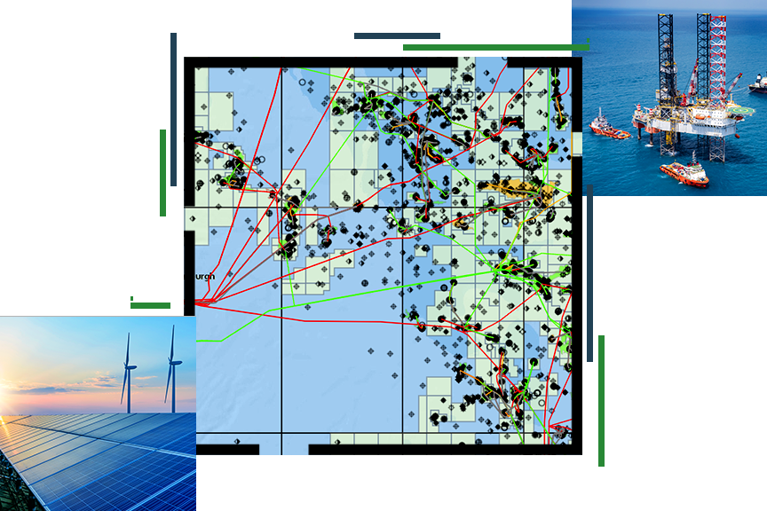
The Application's activities include developing Assets Map Viewer, Operational Dashboards, GeoForm for ArcGIS, and Reporting tool. The Geo-Form allows users to enter asset data using a form designed for asset data entry which in turn adds the data to the central geodatabase after applying for the workflow approval. The Geo-Form facilitates adding all the metadata of the assets and their geographic location and editing them in the form of a geographical layer. While the GIS integration services focus on the integration with the current SAP system for data collection concerning financial data. QSIT offers comprehensive training to EGPC staff with a special focus on capacity building and knowledge transfer to empower them in their new role within the GIS Solution on how to utilize, manage, and maintain the solution…
Golden Points
- Enhancing better protection of assets and environment by holding a unified point of truth view of the company and its assets within one unified geodatabase
- Improving overall service performance in terms of faster and more reliable process
- Providing dynamic and interactive data visualization and data analysis, enabling users to manipulate the map to achieve the utmost benefit according to the business need
- Adopting the latest technologies and trends to minimize corruption
Used Software
- ArcGIS Enterprise
- ArcGIS Server
- ArcGIS Pro tools
- Microsoft SQL Server 2016
- Oracle enterprise edition
- Operations Dashboard for ArcGIS