Cairo Governorate Geoportal - Egypt
Cairo Governorate Centralized Geodatabase
Business Needs
The Cairo Governorate had a large amount of data and maps from multiple sources in multiple formats (paper and digital). Having information scattered across multiple data sources from different departments, hindered supporting decision making with immediate access to valuable information. In addition, paper-based data poses risks of exposing data to damage or loss and other preservation and storage risks.
It is also challenging and time consuming to efficiently extract required information from archived paper data. Cairo Governorate wanted to address all these challenges by having all data from different sources gathered in a unified database linking maps and data, and hence facilitating quick access to accurate information and supporting informed decision-making.
Solution Concept
In order to address the needs of Cairo Governorate and its departments, QSIT established a centralized geodatabase
that hosted the geospatial data of different departments. Different data from multiple sources and in multiple formats was unified in the geodatabase (e.g., through data conversion, and scanning, uploading, and linking paper documents). On top of this geodatabase, QSIT built a unified GIS platform capitalizing on Esri COTS products (ArcGIS for Server and ArcGIS for Desktop).
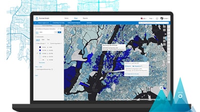
We also implemented Cairo Governorate Geoportal to give respective users access to the different GIS data based on their privileges. In addition, in order to serve the specific needs of different departments, we implemented a number of Esri out-of-the-box applications (ArcGIS Collector, ArcGIS Workforce, ArcGIS Maps for Office, and ArcGIS Dashboards).
To maximize Cairo Governorate staff benefit from the solution, we also provided a knowledge transfer and capacity building program to different departments, training respective staff on how to utilize, manage, and maintain the different applications, according to different user's responsibilities.
Golden Points
- Immediate access to accurate and updated information enabled better-informed decision-making.
- Empower daily decision making with quick access to updated indicators reflected in the implemented operations dashboard.
- Having all data centralized in a unified database facilitated data maintenance and hence ensured higher data accuracy, consistency, and quality.
- Having a unified geo-enabled platform enabled better collaboration between Cairo Governorate departments.
- Enhanced monitoring and control of field operations, and enhanced collaboration between head office and field workers.
- Enhanced staff capacity and efficiency, and hence better performance and less waste of time.
Used Software
- ArcGIS Enterprise
- ArcGIS Server
- ArcGIS Pro tools
- Portal for ArcGIS
- ArcGIS for Desktop
- ArcGIS Web Adaptor
- Microsoft SQL Server 2016
- Operations Dashboard for ArcGIS